INDUSTRIES WE SERVE
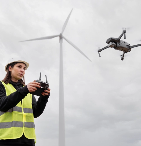
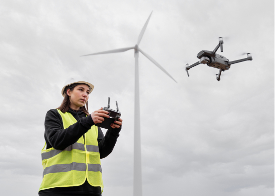
Wind Energy
KGiS offers customized aerial image processing software solutions for the inspection of wind turbines and their blades. Wind turbines require periodic maintenance, which helps them run through various weather conditions, without compromising on the output power. Our image processing software can identify issues as small as 5 to 6 mm, significantly reducing the costs and the labor put into blade inspection.
Telco
Technology evolution has connected the entire world, and radio masts and towers play a crucial role in this advancement. Our customized airborne image processing software facilitates drone inspections in telco towers, enabling experts to perform full tower analysis, and identify and rectify potential failure points in antennas, RRHs, fiber cables, and terminals, among others.
Ports
KGiS delivers customized solutions for photogrammetry on ports and docks that help teams efficiently conduct inspections. Our solution is specifically used in rooftop inspections that identify damages in inventory/warehouses, volumetric analysis of debris along the coastal line that helps in addressing marine pollution, and seawall inspections that gives insights to prevent seawall corrosions. Equipped with the power of modern technology, our services are cost-effective and make the inspection simpler, which might rather be labor-intensive and time-consuming.
Grids
One of the critical applications that we build image processing software is for the inspection of the structures used for electric power transmission (transmission towers) and distribution (electric poles). Our platform analyses the images of the structures acquired either manually or by drones, and identifies the defects effectively. This enables the utility teams to take resolution measures and significantly reduces the potential life risk involved in manual inspection on high-tension lines.
Façade
A building survey is one of the measurements to ensure the integrity of the building structure and the safety of its occupants. The image processing platform from KGiS makes the façade inspection efficient in terms of labor, effort, and cost. The solution is indispensable for owners and construction companies of tall buildings and skyscrapers.
Meat and Livestock
Unlike inspecting structural objects like towers and buildings, the meat and livestock industry requires a silent unmanned inspection. KGiS offers customized image analysis solutions that accurately examine and report data. Our solutions have become vital in many scenarios such as fence and water monitoring, herd location, feedlot inspection, and livestock tagging, among others.
Agriculture
KGiS facilitates precision agriculture through its custom-built UAV application that enables farmers and service providers to analyze airborne images and videos of their cash crops and ensure their health. This not only alleviates the intense labor and costs involved in the maintenance but also increases the crop yields and brings down the cost of food production.
Solar
The renewable energy sector demands accurate data, high-level field safety, and inspection protocols for surveys done through drones. KGiS drone image processing platform redefines the way you collect, analyze and share drone data. Modern features such as cloud processing, real-time analysis, maps, and 3D models make the initiatives easier. It also gives greater visibility over the flight activity and increases the field productivity twofold.
Drone Video Streaming
KGiS offers a real-time video streaming service for software that processes drone data. Normally, photogrammetry requires high-resolution videos for a better understanding of the issues. Our product supports streaming for various devices including drones and static cameras.
CLIENT STORIES
Brands Trust Us
DRONE IMAGE PROCESSING SOFTWARE
KGiS delivers an all-encompassing solution to Malaysian drone inspection company

HELPDESK
Leading Digital Cable TV & Broadband Internet Service provider in India migrates to KGiS ITSM Helpdesk System

EDA TELEHEALTH
KGiS enables a multi-specialty hospital provide improved access to healthcare and quality of care